Credits
Image credits & data sources
Every photo we use, who took it and the license it is used under, plus the open data behind our charts.
Temperature.Vegas is an independent guide. We use real photos only when their license allows it (public domain, CC0, CC BY or CC BY-SA, plus a few Pexels and Unsplash photos), we credit every one, and we never use other organizations' logos. Our charts are original graphics drawn from public data; the data source is printed inside each chart and listed here.
Charts and data graphics (15)
Made by Temperature.Vegas from the data named in each row. The graphics themselves may be reused with a credit to Temperature.Vegas and the data source.
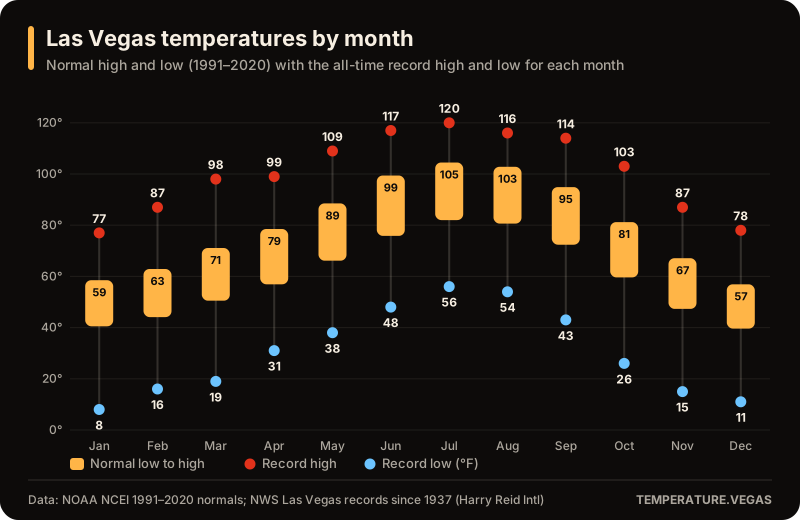
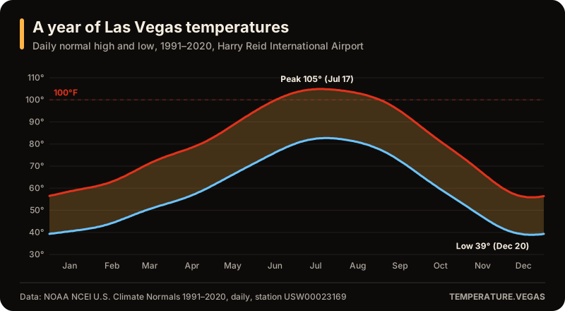
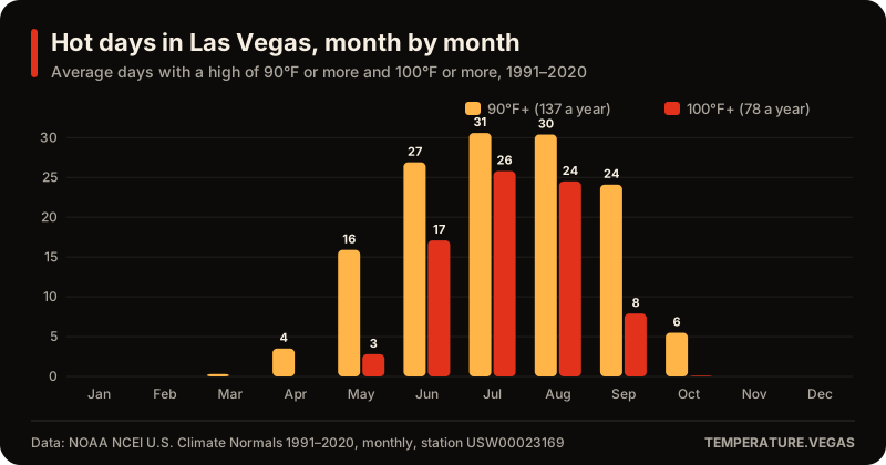
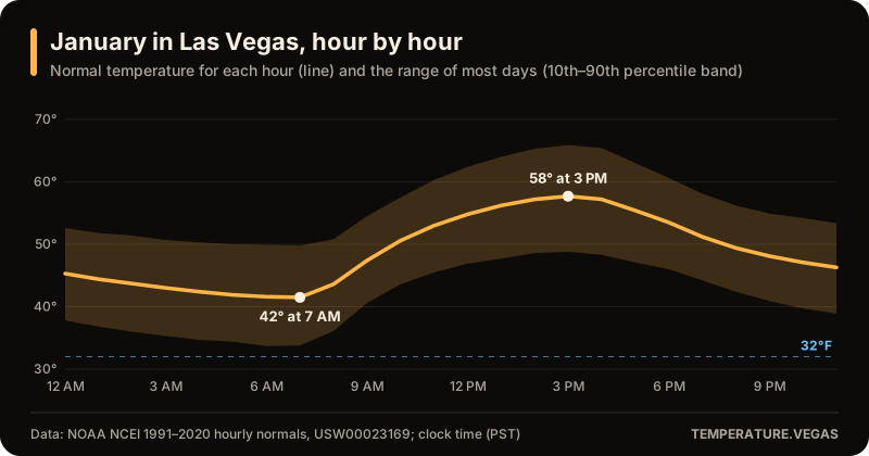
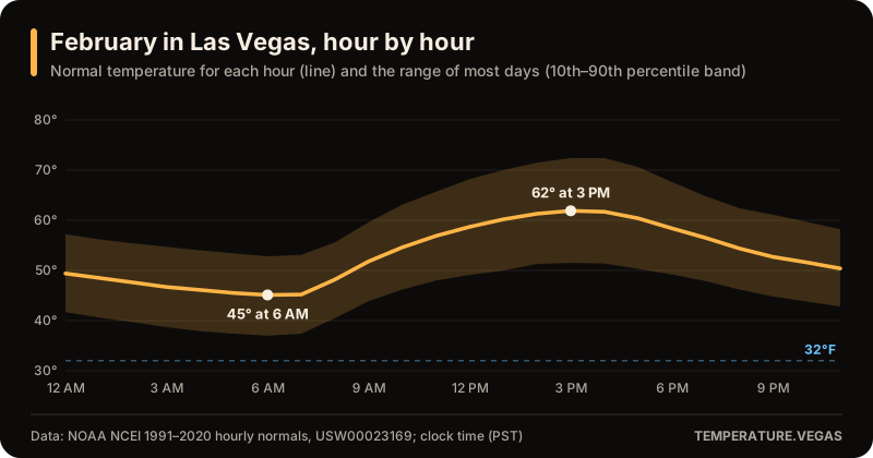
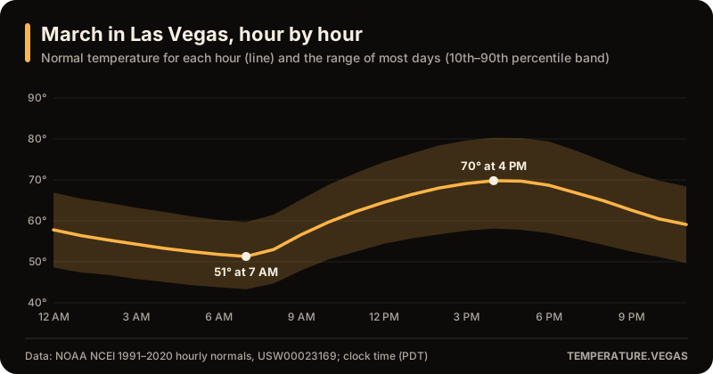
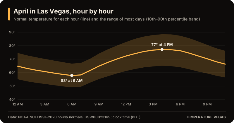
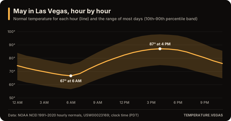
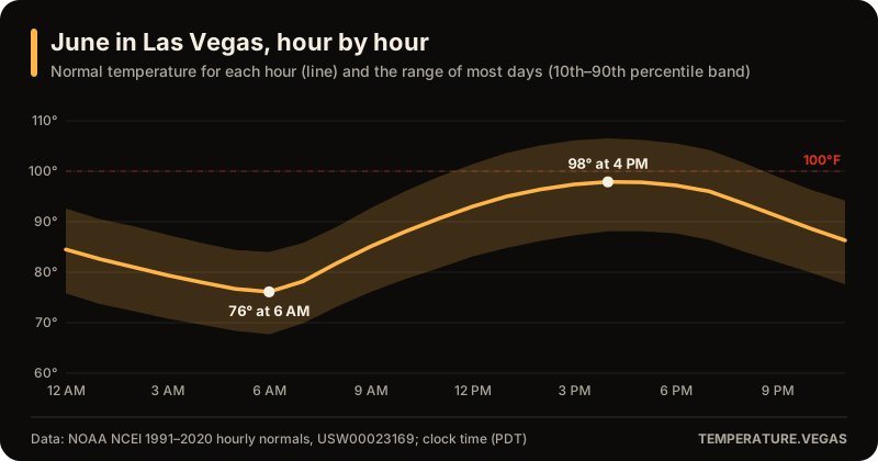
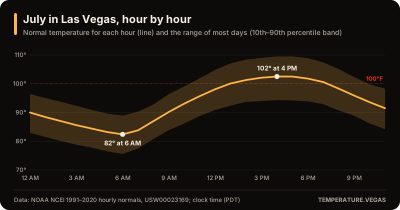
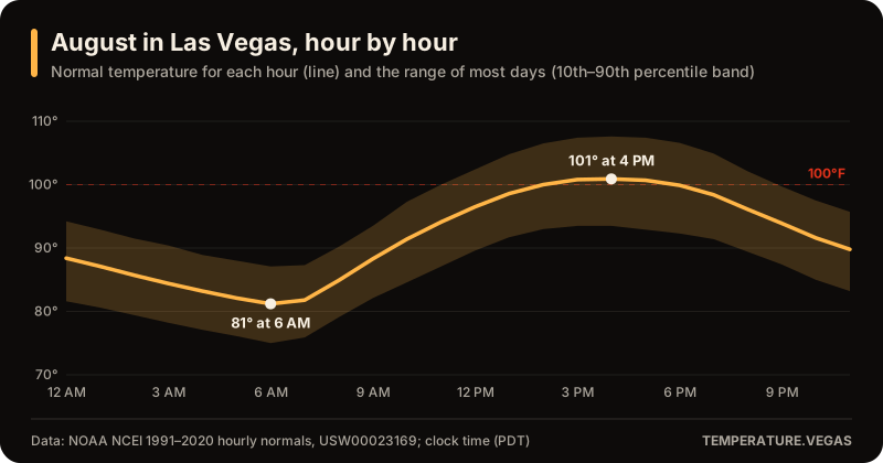
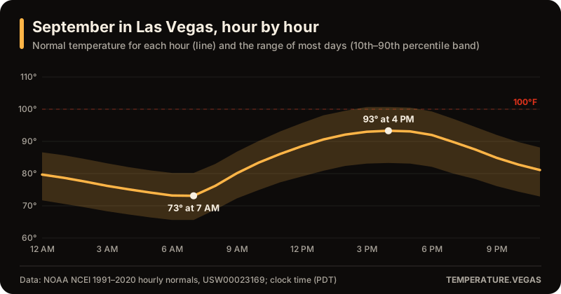
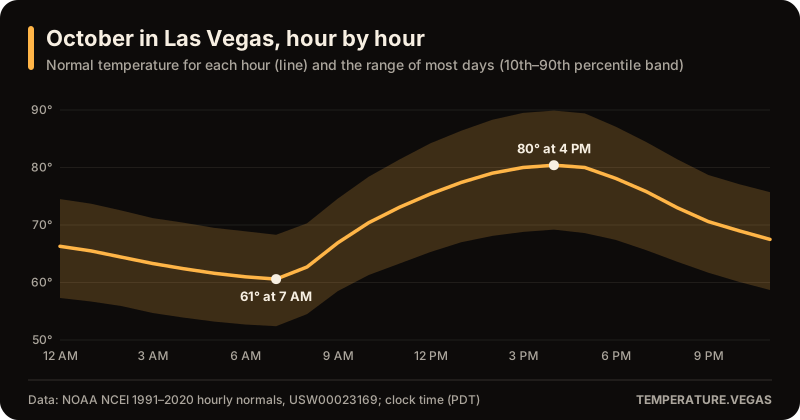
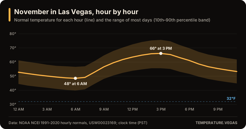
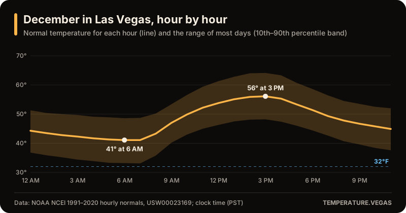
Data sources: NOAA NCEI 1991–2020 hourly normals. Public-domain U.S. government data is used as published; we round values for display and say so in each caption.
Photos (9)
3CC BY-SA 4.0, 2CC BY 2.0, 1CC BY 4.0, 1Pexels License, 1Public domain, 1CC BY-SA 3.0. Photos are self-hosted, resized and recompressed for the web; adaptations of CC BY-SA photos are shared under the same license. U.S. government photos are in the public domain, and using them doesn't imply endorsement by any agency.
| Photo | Author | License | Shown on |
|---|---|---|---|
| The Sphere by day “Sphere-exosphere-in-daytime-on-Jan-27-2024”, Wikimedia Commons | Y2kcrazyjoker4 | CC BY 4.0 | Hero and card images |
| The Strip from the north “Las Vegas Strip from Resorts World February 2023 HDR 1”, Wikimedia Commons | King of Hearts | CC BY-SA 4.0 | Hero and card images |
| The Strip at dusk “Las Vegas Illuminated at Dusk”, Pexels | Stephen Leonardi | Pexels License | Hero and card images |
| Calico Basin, Red Rock Canyon “Red Rock Canyon Panorama - Calico Basin”, Wikimedia Commons | ZooFari | Public domain | Hero and card images |
| The automated weather station (ASOS) at the Las Vegas airport, photographed July 12, 2015. Las Vegas normals and records come from this station's long-running record. “2015-07-12 13 58 23 The Automated Surface Observing System (ASOS) at McCarran International Airport near Las Vegas, Nevada, with the Las Vegas Strip visible in the background”, Wikimedia Commons | Famartin | CC BY-SA 4.0 | /records |
| Thunderstorms over the Las Vegas Strip, seen from Russell Road in Paradise on November 4, 2015. “2015-11-04 16 06 46 View of thunderstorms above the Las Vegas Strip from Russell Road in Paradise, Nevada”, Wikimedia Commons | Famartin | CC BY-SA 4.0 | /months/november |
| Snow still on the ground in Las Vegas after the rare December 2008 snowfall. “LasVegasshowssnowonground dec 20 2008”, Wikimedia Commons | Mike Russell | CC BY-SA 3.0 | /months/december |
| Lightning over the Las Vegas valley on the night of October 19, 2010, a 30-second exposure from Henderson looking toward the Strip. “Las Vegas Lightning Storm”, Wikimedia Commons | Thomas Dwyer from Henderson (Las Vegas), Nevada, USA | CC BY 2.0 | /months/october |
| Floodwater in the Pittman Wash in Henderson after a storm on August 7, 2008. Monsoon storms can fill dry washes in minutes. “Pittman Wash flood 1”, Wikimedia Commons | Julie Vazquez from Henderson, United States | CC BY 2.0 | /months/august |


Corrections and takedowns
Own a photo used here and want the credit changed or the photo removed? Email hello@temperature.vegas with the page address and we will act on it promptly. See also our disclaimer & legal notice.